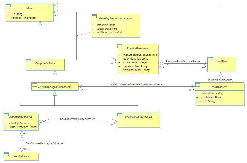
This model defines Address as:<br/><i>“An address is a structured textual way of describing how to find a Location. It is usually composed of an ordered list of Location names based on context specific rules.”</i><br/>Address is split up into Geographic Address and Local Address. Geographic Addresses describe Geographic Locations and Local Addresses describe Local Locations.<br/>Geographic Address caters for Property and (physical) postal Addresses. <br/>Geographic Sub Address caters for Property Sub Addresses.<br/>Local Address caters for a level of granularity smaller than Geographic Address<br/>While it may be possible to derive a Geographic Address from a map point using Geographic Location names [Hay], there are advantages in storing Geographic Address as a separate entity. <br/>Geographic Addresses may be required:<br/> • if the Address cannot always be calculated reliably from a map (e.g. to Post Office standards)<br/> • if a spatial engine is not available<br/> • if suitable spatial street, suburb, post code data is not available<br/> • for logical addresses (e.g. PO Box)<br/> • to achieve required response times. It takes a lot of computation & spatial facilities to derive the address from a map position, so storing it redundantly as text makes sense (easy for selection etc.)<br/><br/>Country specific standards should be implemented using Policies, Templates & Rules.<br/>