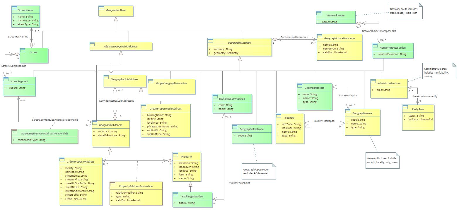
Figure L.10a - Examples of Possible Geographic Locations : Class diagram
Created:
3/28/2022 3:51:09 PM
Modified:
9/27/2023 9:38:49 PM
Project:
Author:
broth
Version:
1.0.0
Advanced:
ID:
{85EF48F9-1E90-4caa-A6EC-0E183AAEF589}
The following Figure shows as an example, an Exchange Service Area, which models an Exchange (Central Office) and the area that it serves. Other examples of Service Areas include Digital Radio Concentrator Systems (DRCS), Fixed Radio Access (FRA) service areas & Pay TV service areas. For wireless service areas (e.g. WiFi, 3G mobile), it may be useful to model the signal strength contours as a collection of areas. <br/>A Simple Geographic Location entity should only be used when there is no unique textual identifier (name or code).<br/><i>Note that there is a Spatial Data Standard [SDSFIE/FMSFIE] that defines around 1,500 feature types. It is not recommended that NGOSS uses its data model, but NGOSS should try and align with their attributes (feature type, name, zymology). It would also be useful if the SDSFIE/FMSFIE standard defined a set of XML schemas that could be used for data interchange (perhaps utilizing the GML [GML] standard).</i><br/>